
Hastings ZIP Code Coverage
The Nebraska Blue Book lists two ZIP entries for Hastings: 68901 and 68902. USPS identifies 68901 as the ordinary street-delivery ZIP used by the Hastings Post Office listing. Use 68902 only when the exact official mailing address supplies it, especially for a PO Box or mail-routing reference. The public research does not provide an official neighborhood map for either ZIP, so the coverage descriptions stay tied to delivery use rather than guessed sections of town.
| ZIP | Areas Covered | Post Office | Notes |
|---|---|---|---|
| 68901 | Ordinary Hastings street-delivery addresses when assigned by USPS | Hastings Post Office | USPS facility listing uses Hastings, NE 68901-9998. |
| 68902 | Hastings PO Box and mail-routing references when the exact official address uses it | Hastings Post Office, verify exact address use | County mailings can carry a 68902 ZIP+4; it is not a neighborhood label. |
The Nebraska Blue Book ZIP table supports the two listed Hastings ZIPs. It does not supply a complete street-by-street or city-limit crosswalk. Do not call 68902 PO-Box-only: the local research did not find an official USPS source that labels every 68902 use that way.
Hastings ZIP Code Delivery Roles
A ZIP is a postal delivery construct, not a legal boundary. A Hastings mailing address can carry a postal city and ZIP while lying outside the City of Hastings line, and an Adams County address may use Hastings as its postal city. Use USPS for delivery formatting. Use the county parcel record and city or county GIS layers when the question is geographic. The two systems answer different questions and should not be used as substitutes for each other.
Census ZCTAs add another layer of caution. The Census describes them as generalized statistical representations of USPS ZIPs, not delivery routes. That means a ZCTA total cannot be treated as an exact city count or a complete list of Hastings addresses. The Census explanation of ZIP data and ZCTAs is the proper starting point when a statistic is needed.
USPS Fields for Hastings ZIP Codes
The official USPS ZIP Code Lookup offers different routes depending on the information already in hand. By Address is the strongest choice when there is a full street location. By City and State is useful when a street is missing, and Cities by ZIP works in the other direction. A returned ZIP standardizes postal information; USPS warns that it does not confirm a person or company at that address.
| USPS route | Fields captured | Use in Hastings research |
|---|---|---|
| By Address | Street address, city, and state required; company, apartment or suite, and ZIP optional | Standardize a known street address before a county lookup. |
| By City and State | City and state required | Check the postal choices for Hastings when no street is available. |
| Cities by ZIP | ZIP required | Confirm the postal city association before using a mail record. |
If USPS returns more than one match, add the unit or ZIP information it requests. That narrowing step keeps a postal correction from being mistaken for an identity match.
Find Residents Within a Hastings ZIP
A ZIP narrows an address search, but it is not a standalone resident list. The safest Hastings sequence moves from postal formatting to a verified street address and then to the record system that is keyed to a parcel or historical edition. The Adams County Assessor's public form does not capture a ZIP field, so use the ZIP to verify the city and address first, then enter the street components that the assessor actually accepts.
- Use USPS By Address, City and State, or Cities by ZIP to check the postal form of the known address.
- Enter house number, street name, and city in the Adams County Assessor search to locate the parcel and its PIN.
- Compare the parcel's legal description with the Adams County GIS map rather than drawing a boundary from the ZIP alone.
- For an older address, use the verified street form to search a dated Hastings directory or local newspaper source.
- Keep the source label clear: postal result, parcel record, recorded deed holder, or historical directory entry each has a different meaning.
Once the ZIP has narrowed the address, the Hastings street directory provides the fuller street-level parcel and record sequence.
Hastings ZIP Parcel Pivots
The Adams County Assessor parcel search accepts house number, street name, city, parcel number, deed holder, contract buyer, legal description, lot, block, section, township, range, and acreage criteria. It also has a Data Usage Disclaimer and combines partial criteria with AND logic. The city selector includes both HASTINGS and Hastings, a duplicate-capitalization quirk worth checking if the first search does not return the expected parcel.
The Assessor result can lead to a parcel number, legal description, property record card, sketch, photo, sales information, and GIS entry points. It is not an occupancy record. The Adams County and City of Hastings GIS adds parcels, subdivisions, lots, zoning, schools, voting precincts, and infrastructure layers. Partner data are updated on the first business day of the month when needed, but a map view remains an aid to reading the recorded legal description.
Once the address has reached a parcel, the ZIP has done its postal work. Keep the parcel number and legal description for the next county record instead of expecting a ZIP search to identify the same place. The Register of Deeds and Deeds Online use recorded instrument details, parties, and legal descriptions for their trail. A parcel result can identify a recorded deed holder, but it does not establish who receives mail or who is physically present at the address.
Note: The GIS research capture did not verify a stable ZIP-layer control, so use its parcel and city context without implying a precise ZIP boundary.
Hastings ZIP Codes and City Limits
No complete official city-to-ZIP crosswalk was located for Hastings. That absence matters. A postal result may be correct for delivery but still fail to establish whether an address is inside the city, in unincorporated Adams County, or in a particular planning area. Check the street address against the Assessor and GIS systems for a parcel question, and retain the exact ZIP+4 in a courthouse or election mailing when the official record gives it.
- ZIP and ZIP+4
- A five-digit ZIP directs mail to a broad delivery area. ZIP+4 adds four digits for a narrower delivery segment and should be preserved when an official mailing address supplies it.
- PO Box ZIP
- A postal designation used for box or routing service. Do not assume every address using a Hastings routing ZIP is a box address without USPS confirmation.
- ZCTA
- A Census statistical area that approximates ZIP geography for data use. It is not the USPS delivery map or the Hastings city boundary.
- Carrier route
- A mail-delivery grouping below the ZIP level. It can help delivery operations but does not define a city district or a person list.
Hastings Post Office Service
The USPS Hastings Post Office listing identifies the facility at 300 N Kansas Ave, Hastings, NE 68901-9998, with phone 402-463-3107.
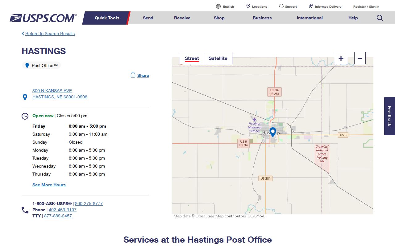
Retail hours listed are Monday through Friday, 8 a.m. to 5 p.m., and Saturday, 9 a.m. to 11 a.m. PO Box access is listed as all day. This facility detail confirms a postal service location, not a ZIP neighborhood boundary.
Hastings License ZIP Results
The Nebraska DHHS License Information System is one state portal that captures ZIP as a search field. Its Individual Search also provides first and last name, license number, status, profession, license type, city, and county fields; separate tabs cover business or service and facility or service records. Use a result to check a regulatory record and its status, not to infer where an individual lives.
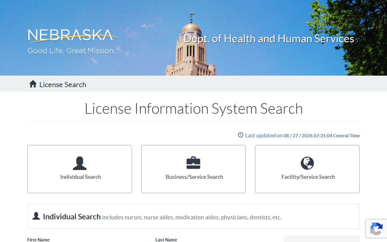
The field layout illustrates why a ZIP-capable state search is not the same as a Hastings address record. A license city or ZIP may be a regulatory contact detail and requires a source-specific reading.
Hastings ZIP Planning Context
Hastings planning materials use South, West, Central, and East quadrants. Those labels can help describe city planning context, but they are not formal ZIP neighborhoods. The 2025 comprehensive plan and the 2026 neighborhood character work use those four broad areas for planning and community discussion. Do not convert a quadrant into a postal boundary or assign an entire ZIP to one of them.
The 2026 character-study report drew on a 2025 survey with 27 responses, while the comprehensive plan notes that 86 percent of the city's structures were built before 1980 and gives a median structure age of 53 years. Those facts can help date the built environment around a historic address. They cannot define postal coverage, establish a ZIP-level population, or describe a particular address without the parcel and map evidence.
For a city-wide scale check, Census QuickFacts reports 25,152 people in the 2020 Census, a July 1, 2025 estimate of 25,121, and 14.90 square miles of land. Those are dated city figures, not ZIP totals. Use the Hastings QuickFacts source when city-wide context is useful, and keep it separate from postal geography.